|
Forums39
Topics40,262
Posts326,477
Members26,828
| |
Most Online4,031
Dec 15th, 2024
|
|
|
Posts: 291
Joined: July 2016
|
|
|
There are no members with birthdays on this day. |
|

#33528
01/11/2015 06:23 PM
|
Joined: Aug 2009
Posts: 2,545
Traveler
|
OP

Traveler
Joined: Aug 2009
Posts: 2,545 |
Any one know what bay the petroglyphs on St John are in? My hubby went there in the 70's and has a cool picture. I will try to post it. We want to try to find them next trip and take another picture of them.
Rita It is better to be happy than it is to be right
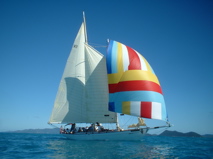
![[Linked Image]](https://tickers.TickerFactory.com/ezt/d/4;10765;128/st/20170709/e/Rita+%26amp%3B+Tim+in+BVI/k/9d22/event.png)
|
|
|
 . .
|
|
|
|
Joined: Aug 2009
Posts: 2,545
Traveler
|
|
OP
Traveler
Joined: Aug 2009
Posts: 2,545 |
Look at the back of the picture dummy. Reef Bay. Any one seen them?
Rita It is better to be happy than it is to be right
|
|
|
|
|
Joined: Aug 2009
Posts: 2,545
Traveler
|
|
OP
Traveler
Joined: Aug 2009
Posts: 2,545 |
Rita It is better to be happy than it is to be right
|
|
|
|
|
Joined: Jun 2011
Posts: 3,493
Traveler
|
|
Traveler
Joined: Jun 2011
Posts: 3,493 |
Oh yes, many times. Never got there by boat though. We've signed up with the National Park Service and hiked down the Reef Bay trail and they brought us back to Cruz Bay via boat. The petroglyphs and the ruins are cool. <img src="http://www.traveltalkonline.com/forums/images/graemlins/Cheers.gif" alt="" />
|
|
|
|
|
Joined: Jun 2011
Posts: 3,493
Traveler
|
|
Traveler
Joined: Jun 2011
Posts: 3,493 |
By the way, we've also hiked to Reef Bay from Little Lamshur which was a nice hike. We checked out the Par Force ruins which were cool also.
|
|
|
|
|
Joined: Sep 2001
Posts: 5,884
Traveler
|
|
Traveler
Joined: Sep 2001
Posts: 5,884 |
Did they move St John to the BVI?? LOL
If you go on the Reef Bay Trail with the National Park rangers, you'll get history, architecture, biology, and all sorts of interesting tidbits. Sign up at the Friends of the VI National Park office. <img src="http://www.traveltalkonline.com/forums/images/graemlins/Thumbsup.gif" alt="" />
[color:"red"]NUTMEG[/color]
Today is the tomorrow you talked about yesterday.
|
|
|
|
|
Joined: Aug 2009
Posts: 2,545
Traveler
|
|
OP
Traveler
Joined: Aug 2009
Posts: 2,545 |
I don't know how many BVI followers actually look at the St Thomas/St John postings so I figured I would post it here. We are going in by boat. Tim hiked up the hill many years ago. Is there trail from the beach?
Last edited by rita_irvine; 01/11/2015 07:09 PM.
Rita It is better to be happy than it is to be right
|
|
|
|
|
Joined: Jun 2011
Posts: 3,493
Traveler
|
|
Traveler
Joined: Jun 2011
Posts: 3,493 |
|
|
|
|
|
Joined: Jun 2011
Posts: 1,347
Traveler
|
|
Traveler
Joined: Jun 2011
Posts: 1,347 |
There are a few NPS moorings in Reef Bay and the trail goes up from the beach - 10-15 min hiking time.
The petroglyphs are just above the high water marks on the fresh water pools - if you go after a good rain the waterfall will be running too!
|
|
|
|
|
Joined: Aug 2009
Posts: 2,545
Traveler
|
|
OP
Traveler
Joined: Aug 2009
Posts: 2,545 |
Thanks. On the list for August
Rita It is better to be happy than it is to be right
|
|
|
|
|
Joined: Sep 2001
Posts: 5,884
Traveler
|
|
Traveler
Joined: Sep 2001
Posts: 5,884 |
rita_irvine said:
I don't know how many BVI followers actually look at the St Thomas/St John postings so I figured I would post it here. We are going in by boat. Tim hiked up the hill many years ago. Is there trail from the beach? Yes, but Rita...the USVI people know about the petroglyphs. <img src="http://www.traveltalkonline.com/forums/images/graemlins/Wink.gif" alt="" /> I still think the ranger tour is the best.
[color:"red"]NUTMEG[/color]
Today is the tomorrow you talked about yesterday.
|
|
|
|
|
Joined: Jul 2004
Posts: 414
Traveler
|
|
Traveler
Joined: Jul 2004
Posts: 414 |
Thanks for bringing this up Rita, I hadn't heard of them. Another adventure to add to the list!
Last edited by beerMe; 01/11/2015 07:29 PM.
Life involves risks, take some prudent ones (NOT with the BVI ferries)!
|
|
|
|
|
Joined: Jun 2011
Posts: 3,493
Traveler
|
|
Traveler
Joined: Jun 2011
Posts: 3,493 |
Rita, take a look at my 4th photo, the bottom right, it's the same spot your husband took that charcoal rubbing! Now that's cool!!
|
|
|
|
|
Joined: Aug 2000
Posts: 84,603 Likes: 38
Traveler
|
|
Traveler
Joined: Aug 2000
Posts: 84,603 Likes: 38 |
Hey Nutmeg, the post is where it belongs now.. <img src="http://www.traveltalkonline.com/forums/images/graemlins/Smile.gif" alt="" />
Carol Hill
|
|
|
|
|
Joined: May 2008
Posts: 870
Traveler
|
|
Traveler
Joined: May 2008
Posts: 870 |
We were there last year and the ranger pointed out another set that was recently (as in the past couple of years) discovered that we didn't see the last time we were there.
We were lucky enough to be there when the water was running.
|
|
|
|
|
Joined: Jun 2011
Posts: 3,493
Traveler
|
|
Traveler
Joined: Jun 2011
Posts: 3,493 |
Photo? <img src="http://www.traveltalkonline.com/forums/images/graemlins/Cheers.gif" alt="" />
|
|
|
|
|
Joined: Aug 2009
Posts: 2,545
Traveler
|
|
OP
Traveler
Joined: Aug 2009
Posts: 2,545 |
We are approaching from the water. Not the top. That's why I posted in BVI. Most charters come from BVI. It made sense to me that if you want info on the water approach you post where most people are in boats are coming from. Thanks to those who gave me the info I was looking for and to BeerMan. Love the pictures.
Rita It is better to be happy than it is to be right
|
|
|
|
|
Joined: May 2011
Posts: 468
Traveler
|
|
Traveler
Joined: May 2011
Posts: 468 |
Although I'm not a big fan of organized tours, I highly recommend the NPS tour. It's an all day affair as I recall, and takes you past many interesting ruins as well as both sets of petroglyphs, ending up in Reef Bay. Then you're transported back to Cruz Bay via boat (again, as I recall).
The more recently discovered petroglyphs are hard to see. And the enthusiasm of your guide will be appreciated!
|
|
|
|
|
Joined: Sep 2001
Posts: 5,884
Traveler
|
|
Traveler
Joined: Sep 2001
Posts: 5,884 |
Rita: There are many people in the USVI who do this trip from the water. Your logic would indicate that I should post questions about White Bay on USVI because so many day trippers go there. <img src="http://www.traveltalkonline.com/forums/images/graemlins/Grin.gif" alt="" /> I would suspect that not too many BVI boaters do this trip. There are only a couple of moorings in Reef Bay and anchoring is not allowed. If you do want to do this on a BVI trip, you might consider making arrangements for the guided tour after you clear customs in Cruz Bay. <img src="http://www.traveltalkonline.com/forums/images/graemlins/Wink.gif" alt="" />
[color:"red"]NUTMEG[/color]
Today is the tomorrow you talked about yesterday.
|
|
|
|
|
Joined: Oct 2004
Posts: 1,974
Traveler
|
|
Traveler
Joined: Oct 2004
Posts: 1,974 |
What localsailor said. If the winds are from the south in August be careful approaching the beach in your dinghy. Great $15 moorings at Lameshure Bay nearby fo overnight.
Cheers, RickG
|
|
|
|
|
Joined: Jun 2011
Posts: 3,493
Traveler
|
|
Traveler
Joined: Jun 2011
Posts: 3,493 |
There was a problem with linking my photo's last night so I removed them, I'll try to repost them after work. It was cool to see the rubbing and then to find the actual petroglyphs in my photo. Now time to drive in the ice...
|
|
|
|
|
Joined: Jul 2011
Posts: 292
Traveler
|
|
Traveler
Joined: Jul 2011
Posts: 292 |
Rita,
As mentioned before the Petroglyphs are located off the Reef Bay trail. The trail starts at Centerline Rd and winds down the mountain 3.6 miles until it hits the beach at Reef Bay. The Petroglyph trail is a spur located roughly 1/2 mile up from the beach. The National Park service offers a walking tour that comes down the entire length of the trail, visits the Petroglyphs and then visits the old sugar plantation ruins at the bottom (near the beach). They then provide transportation via boat back to Cruz Bay - which is worth every penny of the tour fee. Going back up the Reef Bay trail is one of the hardest hikes on STJ.
Reef Bay beach is steep and it does get a pretty good swell, I wouldn't recommend trying to beach a dingy there. Hope this helps.
|
|
|
|
|
Joined: Nov 2000
Posts: 2,303
Traveler
|
|
Traveler
Joined: Nov 2000
Posts: 2,303 |
Rita... check out Trail Bandit's site, the best one on St. John hiking. I am also emailing you my pre-done St. John email with other links of maps and other St. John stuff.
|
|
|
|
|
Joined: Jun 2011
Posts: 3,493
Traveler
|
|
Traveler
Joined: Jun 2011
Posts: 3,493 |
|
|
|
|
|
Joined: Aug 2009
Posts: 2,545
Traveler
|
|
OP
Traveler
Joined: Aug 2009
Posts: 2,545 |
Nutmeg, you and I do not seem to be on the same page with this. It would be helpful if the board would allow simultaneous postings in both BVI and USVI boards. I know there are a lot of people on the BVI board (myself included) who do not regularly check the USVI board. I am trying to reach the broadest audience of people who have done this trip via charter boat. I understand there is a guided tour. That is not what we are interested in. I am specifically looking for information on the best water approach and the hike up from the beach.
For those of you who have shared info about doing this I appreciate it, especially those who gave info on the water approach.
BEERMAN: your pictures are beautiful as always.. DIF setting in
Rita It is better to be happy than it is to be right
|
|
|
|
|
Joined: Aug 2000
Posts: 84,603 Likes: 38
Traveler
|
|
Traveler
Joined: Aug 2000
Posts: 84,603 Likes: 38 |
Don't blame Nutmeg, I was the one who moved this thread here, which is where it belongs.
Carol Hill
|
|
|
|
|
Joined: Jul 2011
Posts: 292
Traveler
|
|
Traveler
Joined: Jul 2011
Posts: 292 |
Best water approach - there isn't one. But if you luck out and come on a calm day you could pick up a ball in Genti Bay, take your dingy over to Reef Bay, navigate the reef, time the swell, jump out and drag your dink 10 feet up a sharp incline. Follow the trail up the hill.
|
|
|
|
|
Joined: Jun 2011
Posts: 1,347
Traveler
|
|
Traveler
Joined: Jun 2011
Posts: 1,347 |
cruzan1 said:
Best water approach - there isn't one. But if you luck out and come on a calm day you could pick up a ball in Genti Bay, take your dingy over to Reef Bay, navigate the reef, time the swell, jump out and drag your dink 10 feet up a sharp incline. Follow the trail up the hill. That is certainly the case -- sometimes. I have been to those Genti Bay moorings many, many times, it is usually quite easy to take a dinghy to the beach and hike up the trail. You do not have to negotiate the reef from the moorings you are inside it,It is best to bring the dinghy up on shore but you can anchor the dinghy if the beach has a steep slope or drop off everyone and return the dinghy to the boat and one person swim in - it is not very far at all. There is sufficient water under the moorings - I ran an 8' draft - the only problem I ever had there was if the moorings were taken - you cannot anchor the big boat. One of the moorings was reserved for the NPS hike pickup boat - They are only there for an hour at the most and they pick up the hikers from the beach in a dinghy a few days a week. I have not been there this past year but was told there are now 3 moorings available - That MAY be true. I have never stayed on the moorings there overnight and would move to Lameshur for that.
|
|
|
|
|
Joined: May 2008
Posts: 870
Traveler
|
|
Traveler
Joined: May 2008
Posts: 870 |
The National Park Service runs the guided hike a couple of times a week and it arrives at lunchtime. Memory of it is we were there at least 20 minutes, maybe 30 minutes. The group takes up most of the rock area.
I mention this because if you want to actively avoid the group, check out the NPS website for tour days.
|
|
|
|
|
 .
>
.
>


![[Linked Image]](http://s564.photobucket.com/user/ritairvine/media/imagejpg1.jpg.html)


![[Linked Image]](http://i1358.photobucket.com/albums/q778/BEERMANRICK/TTOL%20POSTS2/2006Photos164_zps3e94e16d.jpg)
![[Linked Image]](http://i1358.photobucket.com/albums/q778/BEERMANRICK/TTOL%20POSTS2/2006Photos161_zps0c093bf3.jpg)
![[Linked Image]](http://i1358.photobucket.com/albums/q778/BEERMANRICK/TTOL%20POSTS2/2006Photos157_zps1198ae3b.jpg)
![[Linked Image]](http://i1358.photobucket.com/albums/q778/BEERMANRICK/TTOL%20POSTS2/2006Photos156_zpsd64c7355.jpg)