|
|
|
Forums39
Topics40,258
Posts326,435
Members26,827
| |
Most Online4,031
Dec 15th, 2024
|
|
|
Posts: 882
Joined: October 2000
|
|
|
There are no members with birthdays on this day. |
|
|
3 members (FatCat04, 2 invisible),
352
guests, and
60
robots. |
|
Key:
Admin,
Global Mod,
Mod
|
|
|
|
Joined: Nov 2017
Posts: 30
Traveler
|
OP

Traveler
Joined: Nov 2017
Posts: 30 |
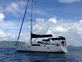
I saw a Facebook post today regarding a 2017 450 Lagoon running aground on a reef off of Great Camanoe this weekend. Someone posted that the owner was on board. Pictures showed the entire starboard hull ripped out. Very sad. I can't help but wonder how this happened. Not sure if it was in the "no-go" zone or just in the vicinity. Looked like it was floated with air bags and towed into Nanny Cay I think. Tragic.
|
|
|
 . .
|
|
|
|
Joined: Jan 2007
Posts: 1,277
Traveler
|
|
Traveler
Joined: Jan 2007
Posts: 1,277 |
NO ONE SHOULD EVER GO BETWEEN CAMANOE AND BEEF ISLAND EVER. This is the single highest marine loss area in the entire BVI. Over and over and over again. Go between Little Camanoe and Great Camanoe. Miss the rock at the top by LIttle Camanoe.
|
|
|
|
|
Joined: Apr 2002
Posts: 7,239 Likes: 4
Traveler
|
|
Traveler
Joined: Apr 2002
Posts: 7,239 Likes: 4 |
I see boats do it all the time despite virtually every charter company briefing it as off limits.
G
|
|
|
|
|
Joined: Apr 2008
Posts: 306
Traveler
|
|
Traveler
Joined: Apr 2008
Posts: 306 |
May we have the facebook link?
Tim
|
|
|
|
|
Joined: Jul 2008
Posts: 3,003
Traveler
|
|
Traveler
Joined: Jul 2008
Posts: 3,003 |
NO ONE SHOULD EVER GO BETWEEN CAMANOE AND BEEF ISLAND EVER. This is the single highest marine loss area in the entire BVI. Over and over and over again. Go between Little Camanoe and Great Camanoe. Miss the rock at the top by LIttle Camanoe. You’re right on, it’s even a bit deceiving with a chart, it even over took Johnson Reef off of St John which used to be the villain for charter boats out of the USVI going to the BVI.
|
|
|
|
|
Joined: Dec 2007
Posts: 2,040
Traveler
|
|
Traveler
Joined: Dec 2007
Posts: 2,040 |
NO ONE SHOULD EVER GO BETWEEN CAMANOE AND BEEF ISLAND EVER. This is the single highest marine loss area in the entire BVI. Over and over and over again. Go between Little Camanoe and Great Camanoe. Miss the rock at the top by LIttle Camanoe. You’re right on, it’s even a bit deceiving with a chart, it even over took Johnson Reef off of St John which used to be the villain for charter boats out of the USVI going to the BVI. The first time I sailed from the BVI to STJ 20 years ago Johnson Reef was on my mind the whole way. Chartplotters were rudimentary then so we were going the old fashioned way - paper and binoculars. I can't imagine someone hitting that reef but I know it has happened recently. I believe even by a commercial captain.
|
|
|
|
|
|
|
 .
.