|
|
|
Forums39
Topics40,277
Posts326,614
Members26,829
| |
Most Online4,031
Dec 15th, 2024
|
|
|
Posts: 767
Joined: January 2017
|
|
|
|
Joined: Nov 2014
Posts: 130
Traveler
|
OP

Traveler
Joined: Nov 2014
Posts: 130 |
Can anybody confirm that this is still the correct approach to Anegada? http://bvipirate.com/NavToAnegada.htmlEspecially that this waypoint is correct as first point to go to? N18 42.100 W64 24.200
|
|
|
 . .
|
|
|
|
Joined: Oct 2000
Posts: 4,597
Traveler
|
|
Traveler
Joined: Oct 2000
Posts: 4,597 |
Everything on the Navigating To Anegada page is still correct.
The approach waypoint that you mention is included for safety. From that position, you should be able to see the outer channel buoys, and you have a bit of room to the east of any rhumb line to that waypoint to allow for some error in navigation. If you go from Colquhoun directly to the outer channel buoys, you will not have much room for navigation errors to eastward of the rhumb line.
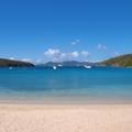
Walker Mangum
Cow Wreck Beach, Anegada
|
|
|
|
|
|
|
 .
.